Soviet Military Maps Free
Available map layers:
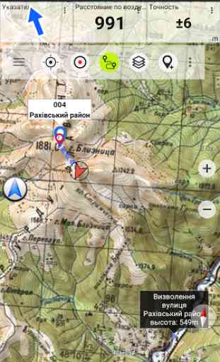
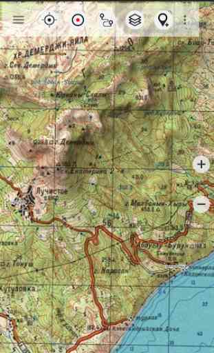
• Topomaps worldwide (worldwide seamless coverage, mainly 1:100.000)
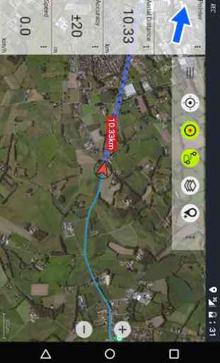
• Google Maps (Satellite images, Road
- and Terrain-Map)
• Open Street Maps (OSM Mapnik, Osmarender and Cloudemade Cyclemap)
• Bing Maps
This app gives you similar mapping options as you might know from Garmin or Magellan GPS handhelds.
Main features for Outdoor-Navigation:
• Create and edit Waypoints
• GoTo-Waypoint-Navigation
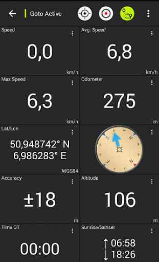
• Track Recording (with speed and elevation profile)
• Tripmaster with fields for odometer, average speed, bearing, elevation, etc.
• GPX-Import / Export, KML-Export
• Search (placenames, POIs, streets)
• Customizable datafields in Map View and Tripmaster (e.g. Speed, Distance, Compass, ...)
• Bulk-download of map tiles for OFFLINE USAGE (NOT in free version)
• Waypoint-/Track-Sharing (via eMail, Facebook, ..)
• and many more ...
Soviet Military Maps is the perfect moving map app for offroad trips, adventure travels and expeditions. You are planning cross country trips to Sahara desert or a trekking tour to the Himalayas ? With the Russian topos you have always a great alternative to other map sources. Beneath the good topography the maps include many small trails and unpaved roads that are missing in other map sets.The Russian maps have additional English labels.Attention: The Soviet Military Maps were created mainly in the 80ies and are less interesting for industrialized countries. Outside Africa and Asia you'll find the OSM / Google map layers more useful.Please note: This app does not provide direct "Turn-by-Turn" navigation
- but with a selected waypoint you can easily switch to Google Navigation.
LIMITATIONS OF THE FREE VERSION:
• Ads
• Max. 3 Waypoints
• Max. 3 Tracks
• No import of waypoints and tracks
• No Bulkdownload
• No Local City DB (Offline Search)
• No Hillshading Overlay
Please contact us if you have any questions, feature requests or bug reports regarding this app: [email protected]
You can browse the Soviet Military Maps here (only up to zoom level 12): http://www.topomapper.comSee the coverage of the different map scales: http://www.topomapper.com/images/topomapper-coverage.jpg
Map coverage: Scale 1:100.000 and 1:200.000 :Europe, Afghanistan, Azerbaijan, Georgia, Japan, Jordan, Latvia, Lithuania, Kazakhstan, Kyrgyzstan, Morocco, Mongolia, Pakistan, Russia, Syria, Tajikistan, Turkey, Turkmenistan, Ukraine, Uzbekistan, Belarus
Scale 1:200.000 :Afghanistan, Egypt, Algeria, Angola, Argentina, Armenia, Azerbaijan, Bahrain, Bangladesh, Belarus, Benin, Bhutan, Bolivia, Botswana, British Virgin Islands, Bulgaria, Burkina Faso, Burma, Cambodia, Cameroon, Central African Republic, Chad, Chile, China, Comoros, Ivory Coast, Cuba, Cyprus, Czech Republic, DR Congo (part), Djibouti, Eritrea, Estonia, Ethiopia, Falkland Islands, Finland, Gambia, Georgia, Ghana, Guinea, Guinea-Bissau, Iceland, India, Indonesia, Iran, Iraq, Israel, Jamaica, Jordan, Kazakhstan, Kenya (part), Kuwait, Kyrgyzstan, Laos, Latvia, Lebanon, Lesotho, Liberia, Libya, Lithuania, Madagascar, Malawi, Malaysia, Mali, Mauritania, Moldova, Mongolia , Morocco, Mozambique, Namibia, Nepal, Niger, Nigeria, North Korea, Oman, Pakistan, Philippines, Qatar, Romania, Russia, Saudi Arabia, Senegal, Sierra Leone, Singapore, Slovakia, Somalia, South Africa, South Korea, Spain, Sri Lanka , Sudan, Svalbard, Swaziland, Sweden, Syria, Taiwan, Tajikistan, Tanzania (part), Thailand, The Gambia, Togo, Tunisia, Turkey, Turkmenistan, Ukraine, United Arab Emirates, Uzbekistan, Vietnam, Western Sahara, Yemen, Zambia, Zimbabwe
Scale 1:250.000 (Local maps from USGS, Geoscience Australia, CTIO ):USA, Canada, Australia
Scale 1:500.000:All other countries
Map legend and cyrillic alphabet:http://www.topomapper.com/PDF/Soviet_Military_Maps_Documentation.pdf
Category : Maps & Navigation
Reviews (25)
It is amazing map! Very detailed maps(but with time some details changed of course). This app is reliable and accurate, nice thing for traveling, you can found some interesting places or you can plan details of your trip knowing the topography of area.
I checked this app on terrain familiar to me and its really amazing. better than Google maps. maybe there are better maps too. but for my MTB tours is more than Ok. is it possible to have one version non my lap top. I purchased pro version
Was useful even when only old topo maps were available, and today evolved into an even more useful multi-layer map app. Google terrain (especially overzoom) works even better then in Google Maps.
Very happy with this app; at home and when travelling to remote places. Although the info is not up to date (regarding villages and roads) it is very usefull for trips to the mountains ....be it Central Asia or the Himalaya.
Good basic functionality on the sea, not well developed and intuitive Way point management. Could be better translated to English, e.g. to delete WP, you need to tap Close instead of Del
I like it, useable when offline. If you want to see the satellite view of your house(top view photo) you must have internet access. Just choose the type of map you want.
it works very well. it supports many types of maps. perfect for using on an Android watch!
its very good but in every opption its want the pro version and another problem is that the google earth is not avilable without the internet please do added the google even internet not avilable and more increase the number of waypoint for save the place with names more and more
Very fast & responsive. Beside soviet topo maps it includes many other map bases as OSM, Google, Bing etc.
I am using "pro" version and have a question to developer: map caching speed is being severely shaped after some tens of seconds of download. Seems not fair play :(
it's an amazing and accurate map.
Great maps. very clear and fun to use. Coordinates wouldn't work though, but it might be because I'm using a tablet.
Awesome! i've found a CAVE in my town! The coverage and different maps for zooming are stunning!
impressive, but those maps are too old to be viable 100% thou its quite cool to see a Soviet detailed map prints of almost any place on earth
It is great app. The detail information is accurate and very helpful. Thank you.
surprisingly accurate even for the middle-of-nowhere village i live in, 100000 times better than google maps tbh
Good but place names are really different in Russian,so I found MapsME instead.
Excellent for countries with no cartography available.
I love it. It has everything I wanted in one app. Best map app. Thanks!
very hepl guid to travel in fishing time..but y? not to view map lands
so easy map For every one to use it with alots of functions if know some one
What is the map key
Great topographical detail even though it isn't recent.
I like this app. Who knew the USSR made topo maps this detailed of this country!
I used app' in 2016,it is good user friendly interface.However the developer should improve on grid accuracies, waypoints activation which exceeds more than 3 positions on the map,it embarrasses bcoz of limited savings of user's points on the map.improve on, make it a 4or 5 generation map, allow it to use satellites aerial map.