SuperSurv M3 Lite--GIS App
An easy-to use mobile GIS app for field data collection
1st App to edit GIS data in complete off-line mode1st App to record attributes in custom menuSave at least 70% of work time than traditional data collection
Visit SuperSurv FB Fan Page for the most updated and exclusive information at https://www.facebook.com/SuperSurv
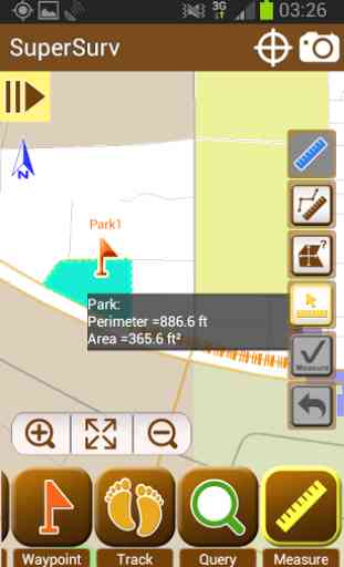
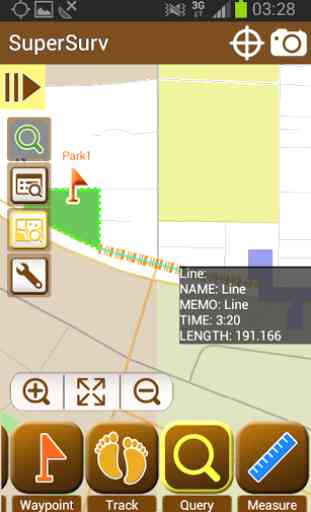
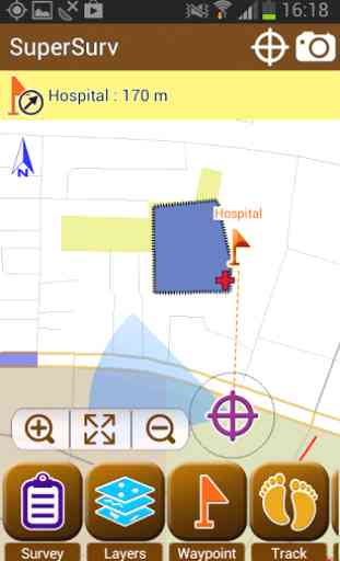
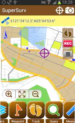
Key features in SuperSurv M3 Lite:1. Free base maps from OpenStreetMap2. Geo-tagging to save XY info for surveyed targets 3. On-screen spatial query and measurement tools4. Various types of point, line and polygon symbols5. Collect features automatically or manually by real-time GPS6. Offline data capture & edit (SHP/ GEO)7. Support global users with local coordinate systems
Integrating with GIS and GPS, SuperSurv M3 Lite is the mobile GIS app for users, no matter an experienced GIS professional or a young surveyor, to easily collect and survey spatial data (including attributes) in the field with Android devices.
The main functions of SuperSurv M3 include data collection, orientation, and map display. With the built-in GPS functions, the data of point, line and polygon can all be captured quickly. Users can apply OpenStreetMap as the basemap to collect spatial data and save the data as SHP/ GEO files.
All the collected data can be exported and applied to desktop GIS applications, like SuperGIS Desktop 3.2 (http://www.supergeotek.com/productpage_SG3.aspx).
The free version allows users to try the complete functions for 7 days. To continue experience the powerful GIS functions, please purchase the paid version--SuperSurv M3.
Learn more about SuperSurv: http://www.supergeotek.com/productpage_SuperSurv.aspx?Type=Editions
1st App to edit GIS data in complete off-line mode1st App to record attributes in custom menuSave at least 70% of work time than traditional data collection
Visit SuperSurv FB Fan Page for the most updated and exclusive information at https://www.facebook.com/SuperSurv
Key features in SuperSurv M3 Lite:1. Free base maps from OpenStreetMap2. Geo-tagging to save XY info for surveyed targets 3. On-screen spatial query and measurement tools4. Various types of point, line and polygon symbols5. Collect features automatically or manually by real-time GPS6. Offline data capture & edit (SHP/ GEO)7. Support global users with local coordinate systems
Integrating with GIS and GPS, SuperSurv M3 Lite is the mobile GIS app for users, no matter an experienced GIS professional or a young surveyor, to easily collect and survey spatial data (including attributes) in the field with Android devices.
The main functions of SuperSurv M3 include data collection, orientation, and map display. With the built-in GPS functions, the data of point, line and polygon can all be captured quickly. Users can apply OpenStreetMap as the basemap to collect spatial data and save the data as SHP/ GEO files.
All the collected data can be exported and applied to desktop GIS applications, like SuperGIS Desktop 3.2 (http://www.supergeotek.com/productpage_SG3.aspx).
The free version allows users to try the complete functions for 7 days. To continue experience the powerful GIS functions, please purchase the paid version--SuperSurv M3.
Learn more about SuperSurv: http://www.supergeotek.com/productpage_SuperSurv.aspx?Type=Editions
Category : Tools
Related searches
Reviews (2)
Her. E. S.
Jan 24, 2015
Best GIS app for android. Kudos!
The best GIS surveying application on the store