Terra Map - Outdoor GPS
►► Features:
• Amazingly clear topo maps, check on our viewer http://www.globalterramaps.com/TerraViewerEditing.html before you buy the App.
• Easy to use user interface.
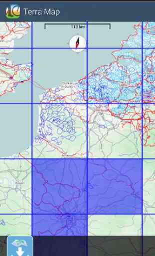
• You can download maps (for FREE, no additional purchase is required) on the device, to be used later without any internet connection.
• Topo Maps for US, Canada, South America, Europe, AU, NZ, Asia, Africa.
• Store your track without the need of cellular data or phone signal.
• Receive/make phone calls and text while track's recording.
• Share tracks, markers and photos in various formats (KMZ and GPX).
• Load any track and marker from internet communities (KMZ, GPX)
• You can enable unlimited storage purchasing the PRO version from the app.
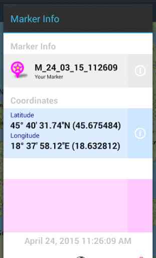
• Customize your Marker's icon and Track's color.
• Switch between Map display modes (Offline, Satellite, Streets).
• Graph of the elevation profile
• Graph of speed and pace (time for a kilometer)
► BACKGROUND MODEYou can run Terra Map in background and while phone is locked. Receive/make calls and texts while the track recording is running.
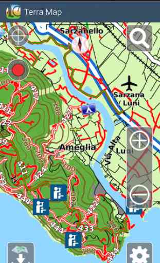
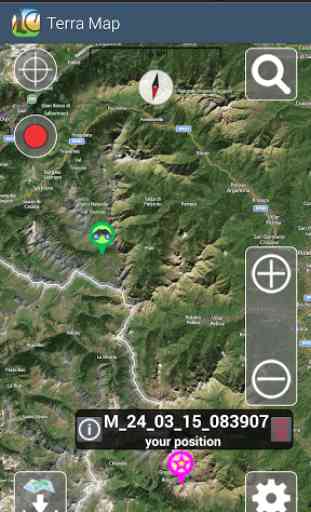
► MAPSTerra Map lets you download — for FREE !!! — the best topo maps with elevation contours, trails, huts, parks, etc. and all it is necessary to enjoy your best outdoor experience and no additional purchase is required. With an amazingly clear display at all zoom levels, you can download the maps at home within your device and then use them without any Internet connection need. Check our map at: www.globalterramaps.com/terraviewer.html
► SHARINGWhy not sharing your favorite's markers sending an email with your last daily track, with all the pictures you captured to show them on Google Earth™ or Maps ? With Terra Map it is just a click.
► LOADING TRACKS AND MARKERSyou can load and display within Terra Map any kml, kmz, gpx (although zipped) available on the Internet or shared by a friend. You can load tracks and markers created from any PC application (e.g., Google Earth™, Maps), other apps Mobile, (including Terra Map), or any device (e.g., Garmin Nuvi, Magellan, etc.). Visit our website www.globalterramaps/GPSTracks.html to find tracks and kmz gpx.
► ELEVATION AND SPEED GRAPHS Record all important info of your track and plot the graph of elevation and the graph of the speed.
————
For more information please visit our website at:www.globalterramaps.com or send us an email at: [email protected]
Category : Travel & Local
Reviews (7)
I had a terrible time on site trying to input coordinates into my Android device. Each time I put in a specific coord, and pressed save, the app then inexplicably changed it. My partner who was using the app on apple had no such problem. End result, her coordinates were accurate, mine were out by hundreds of meters - which in fact could have been dangerous. It was a really annoying and frustrating problem - and it seemed like a bug on the android app so can someone please explain what this bug is? Otherwise, the app works well when moving from A to B to C and back and was otherwise reliable. Two requests: 1) Is it possible to save the google map images in addition to the terrain maps? (I am a user from Australia). 2) When I draw a line from A to B, why does it disappear each time I move the map around? When using the app in the bush to move from A to B, I want to be able to walk a line from specific place A to specitic place B and navigate without having to reload the line ever time.
it sometimes feels a little clunky, but I absolutely love having a GPS-enabled trail map that can use offline data.
Doesn't fit the window. Doesn't show the keyboard. Simply, doesn't work
Can't log into GEC acount? Can you help please?
It's good for a free app. Needs ability to select datum and coordinate format and an export feature. Love the camera option to create waypoint. If I could draw some of the missing trails in my area then this would get another star just for that. I also love the easy to select areas for download, but they are so big! Lots of area I don't need.
Good app that needs some refinement. Shuts done after starting the first time. Runs correctly after restart. Slow to display new views of map overlay when zooming.EXCELLENT intuitive method for locating tiles to download. Good global maps. This app has potential.Try it !!
Love this ap, but it keeps constantly crashing. Please fix. Lately every time I try to update tiles it crashes as soon as I press the start button.