Trails Tatra Mountains
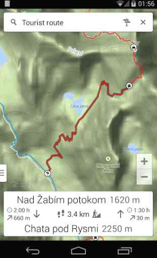
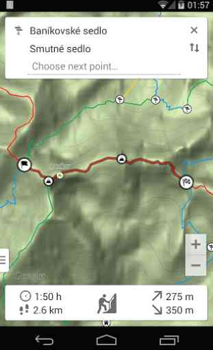
The key feature of the application is a trail calculator that searches for the best route and estimates total hiking time. You just need to select the starting point of the hike and your destination. The application will calculate the fastest or the shortest route, display it on the map and show details such as estimated time, distance to be covered, altitude difference and an approximate level of technical difficulties.
The whole functionality of the application:
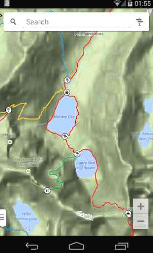
- Interactive trails map;
- Searching for places available for sightseeing;
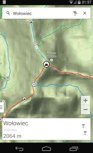
- Information about peaks, passes and trail crossings;
- Hiking time along each trail;
- Distance, total ascent and difficulty of each trail;
- Finding the quickest or the shortest route;
- Route profile graph.
Question: How to enter the planning trip mode? Answer: After loading the application click the signpost icon in the search panel. Select the starting point and then all the next points you want to visit. To change the selected points use the back button of your mobile device.
Question: How do I change the map mode or the search mode? Answer: Click the handle on the bottom left corner of the screen or perform the slide gesture from the left edge of the screen. Select your option in the panel.
Question: How to show route profile graph?Answer: Create route by entering planning mode and clicking points you want to visit. Then click on summary panel to display route listing. Swipe left to show profile graph.
The application is free and has no ads! We hope for a positive feedback from the users and we will try to provide new features. Please send your suggestions, ideas, error reports or inaccurate information.
Category : Travel & Local
Reviews (14)
Great App for trecking in the Tatras - it helps you plan routes, and informs how long the trek will take in terms of time, distance and ascent and descent.
Great for planning hikes and for use on the trails.
I wish all Slovak trails had a map like this, perfect!
Great app for navigating the Tatra mountains
Excellent! I am really happy i have found this app! It would be perfect to have covered all touristic routs in future - big thank you!
I just wish it had Low Tatras and possibly other mountains in Slovakia.
Awesome trip planner and map. Thanks a lot! One note: if it had gps on it, it'd be the best-selling app of the Tatras.
Great idea and quality 👍
Thanks for adding parking places. Very helpful.
If only I could save my route or share it via email I would rate it 5 stars. Anyway it's really nice and fast route calculator for tatra mountain trekkers...
always wanted quickly estimate time of my planned mountain trip and that's the reason why I've written this application, I wish to add more features in the near future, I hope you'll enjoy the app and your next mountain trip, see you in the mountains!
Helped a lot, thanks! Inclusion of Low Tatras would be great!
I think app is great, just wondering if gpx export file will be available to obtain from the app?
Cool app, also I'd like to see my current elevation and what distance is left to the selected point.