
UoB Campus Map
Building to building navigation, study space locations, café opening times and event updates have all been consolidated within the digital campus map.
Obtain useful travel advice on the various means of getting to and from the campuses including real-time bus and train information and supporting information on the location of cafés, shops and toilets.
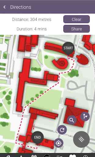
In conjunction with the University's disabled access forum, the flexible routing capabilities have been used to ensure appropriate paths are selected for impaired mobility users. On occasions when paths or facilities (e.g. lifts or stairs) are closed, the system automatically takes this into account when calculating the best path.
Please use the feedback form within the settings menu to send us any issues, suggestions or comments to be considered in preparation for the next release.
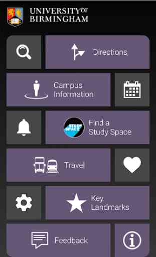
Summary of Key Features:
Quick search: shows the location of any building or facility on campus with extra information options for key locations.
Directions: Navigation given to any location from any point on campus with the route plotted on the campus map. Stair-free routing can be selected prior to running a search, please access settings to adjust your preferences.
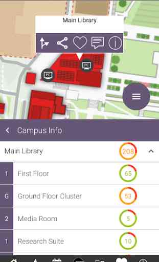
Study Space: Quickly identify the best locations to study on campus.
Additional Categories: Cafes, shops, toilets and bus stops can be selected and the relevant icons will be displayed on the map indicating their position. Further information such as opening times, photos and links to location web sites can be obtained by touching the icon.
Events: University event details can be viewed and listed by date, category and venue. Navigation is given to the venue hosting the event. Event Information is taken from the central University webpages.
Campus Mile: The campus mile is an easy way to get some exercise, take a break and enjoy some exercise. It's perfect for a lunchtime walk, or if you are looking to kick-start your fitness routine you might choose to jog or run it. You can expect to clock up at least 2,000 steps.
Category : Maps & Navigation
Reviews (11)
It could be improved by indicating where there are cobbles (Uni Road East) or steep slopes (terrace Road) and providing ways on the step free access to avoid these routes as the are difficult for wheelchair users to navigate.
Performance is dreadful - spent ages waiting for screen to update and app to be ready to use. Ending up using paper map
It doesn't like to load up my timetable some days, nor does it let me use the map for directions to places.
Fantastic app!! The study space feature will be a great tool for students across campus.
Unfortunatly I have to give 1 star as the app crashes the moment I try to open it on my phone. For reference I have a first generation Motorola Moto G running android 4.4.4
Very useful app, great navigation around a very large campus
Completely inoperable, crashes when launching.
Crashes every time I try to open it
the app is really good, user friendly and mega-useful
Does not load on my phone
My moto just went to A10 thought this app might work now. Reinstalled. Crashed again. Very annoying. Never been any help for this. Guess I'll have to learn my campus the hard way and 'sorry friend can't help you get to somewhere near'