US Army Map Symbols
Application describes topographic symbols used for interpretation of US military maps.
Symbols given in this application are in general agreement with those employed by the British Army, the Canadian Army, the Aeronautical Chart and Information Service of the US Air Force, the Hydrographic Office of the US Navy, the US Coast and Geodetic Survey, the US Forest Service, the US Geological Servey and others.
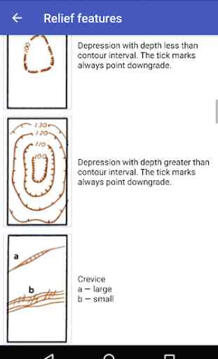
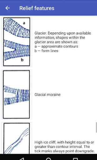
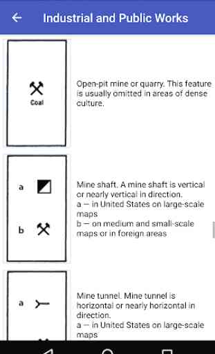
Topographic symbols are arranged by categories, such as drainage features, relief, roads etc.
Symbols given in this application are in general agreement with those employed by the British Army, the Canadian Army, the Aeronautical Chart and Information Service of the US Air Force, the Hydrographic Office of the US Navy, the US Coast and Geodetic Survey, the US Forest Service, the US Geological Servey and others.
Topographic symbols are arranged by categories, such as drainage features, relief, roads etc.
Category : Maps & Navigation
Related searches