VOR ILS GPS
Use only in Visual Meteorological Conditions.
Do not use as single source of guidance.
The developer is not responsible for damage resulting from incorrect usage of this application.
The developer do not access to you personal information, contacts, or pictures. The application saves a list with your waypoints in the mobile, therefore the access to your file system is required. The ad providers require also non personal information to confirm if a click has been done on an ad. You can read more about our privacy policy in the settings screen of the application.
- You must define a reference point: VOR, ADF, NDB, or the touchdown point of a runway.
- The Horizontal Situation Indicator will provide indications to this point.
- The green arrow indicates the heading to the reference point.
- If the reference point is the touchdown point in a runway, the HSI will provide also indications to fly a 3º glideslope to that point (simulating an ILS approach).
- Choose the course you want to follow. The Course Deviation Indicator will diplay a deviation up to 10º each side of the selected course.
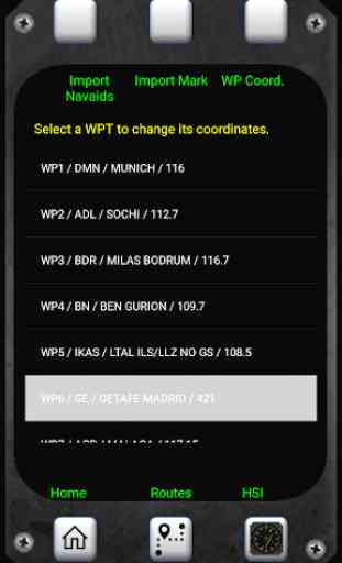
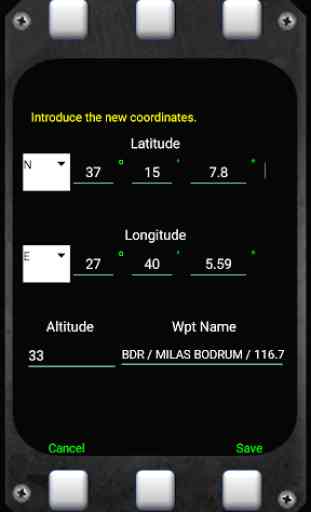
- The reference point must be defined introducing its coordinates and gps altitude. You can introduce up to 20 waypoints.
- You can save the coordinates of your current position by pressing the Mark button and importing them as a new waypoint.
Example:
N 40º 22' 12.92"
W 003º 46' 36.4"
Connect the location sensor of your device.
The information provided during the first two minutes (mainly the altitude data) will not be reliable.
Warning: Some devices do not provide gps data when in battery low mode.
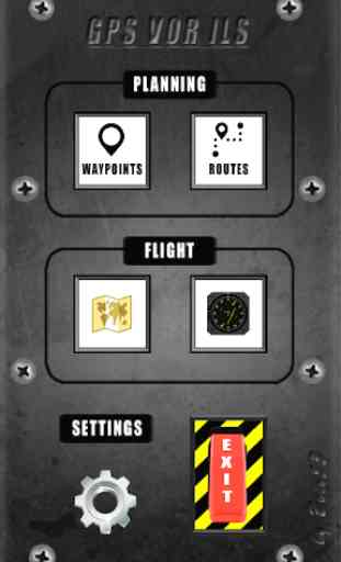
Category : Maps & Navigation
Reviews (9)
Badly designed. Developer has no sense of UI experience. Forces you to watch adverts when download countries and then when it can't deliver any adds its useless. Box for typing in country isn't even the right size ffs. Check your apps before publishing.
Wonderful App. ILS works just fine and GPS works great. It shows unusually high amounts of battery usage in my phone's settings even on a day I have never launched the app. Even tried restricting background use but still used too much battery.
Great Britain / United Kingdom not in country list so unable to setup and try!
Compass rose not moving so useless
Nice carry on +adding
works well....more than i expected !
It is not VOR or ILS. Its an HSI indicator. There is no navaid info...
Unless I've completely forgotten how to read a chart this thing is telling me my local airport is over 6000nm away. Junk.
I plan to use this app to fly to specific points on the globe. I hope to be able to use it after the point has gone out of sight below the nose of the aircraft to fly directly over it. So far I have only used it on the ground to check if it stands a chance of serving my purpose. As I can add coordinates to the virtual navaids it seems ideal. I have experimented with it in my car and on a commercial flight and it seems to work fine in those situations. I will report here what I find after I have tried to use it for my purpose in the air. Regards, Chris