Wisconsin Waterways
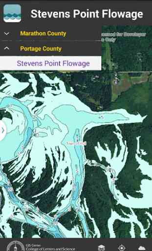
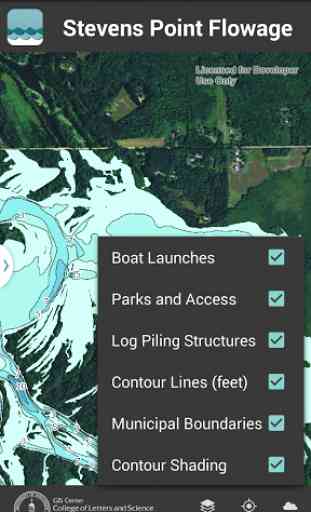
The Wisconsin Waterways app shows depth contours (in feet) and map information for several Central Wisconsin water bodies including the Stevens Point Flowage (Portage County), Lake Wausau (Marathon County), and eleven Eastern Marathon County Lakes. In addition to water depth contour information under normal water-level conditions, the app also includes the locations of old log pilings (Stevens Point flowage only), points of interest such as nearby parks and boat launch locations, and municipal boundaries. Each map layer can be added or removed to suit user needs.
Features:
• Select from multiple water bodies
• Add/remove map layers
• Geo-location
• Picture taking
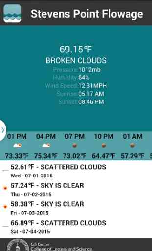
• Current and predicted weather reports
Features:
• Select from multiple water bodies
• Add/remove map layers
• Geo-location
• Picture taking
• Current and predicted weather reports
Category : Travel & Local
Related searches
Reviews (7)
Mab. O.
Aug 10, 2015
Don't stop here, move on north to langlade, vilas, forest, etc. Would pay for comprehensive easy access app for the northwoods.
Chr. S.
Aug 22, 2016
Works perfect on my phone, not sure why someone else had issues with it being slow. Useful tool for fisherman looking for deeper spots. Glad to see it was made by UWSP:) Go pointers!!
Dan. F.
Jul 25, 2015
Great job UWSP! I've been wanting this section of the river to be mapped for so long!
Dea.
Aug 2, 2015
Nice app but runs slow.
Tim. K.
Jul 2, 2015
Great app if you're going to hit the water in Central Wisconsin!
Jos. M.
Jul 2, 2015
Well put together and intuitive.
This app is great but it's a little slow and glitchy if it was refined more and had more counties I would definitely pay for it