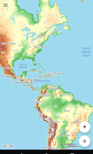
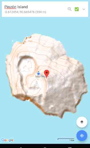
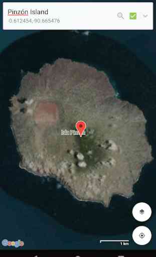
World Topo Map
• View and cache topographic tiles and satellite imagery
• Cache all topographic tiles in a visible region (for offline availability)
• Add unlimited map markers
• Show your location and distance to markers (in a straight line)
• Import / export GPX and KML waypoints
• Import GPX and KML tracks (shows path and distances)
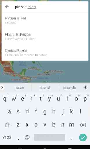
• Search for places of interest (supports decimal coordinates)
• Battery conscious (for those that can't recharge every day)
• Space conscious (for those that don't have gigabytes to spare; external SD card support)
• Stay up-to-date (delete / refresh the cache, no waiting for application updates)
• Navigate with Google Maps interactions (pinch zoom, scroll, rotate, drop marker, drag marker etc)
• Fully functional for free! (no subscription, lite or pro versions required)
World Topo Map is intended for outdoor enthusiasts who want to mark locations visited, create markers to visit or follow imported tracks. It does not provide detailed track information, record while walking, show speed etc. It's designed to be lightweight, intuitive, responsive, battery conscious and totally free. Perfect for casual day trips to serious bush excursions.
Developed by an adventurous person for adventurous people!
Topographic Map Tiles
OpenTopoMap is a free, topographic map generated from the data in the OpenStreetMap and SRTM elevation data.
This service provides excellent topographic coverage of most of the globe, however there may be areas and zoom levels with no topographic information.
OpenTopoMap is licensed under CC-BY-SA (opentopomap.org)
Analytics
World Topo Map uses Google Analytics to anonymously send application metrics to measure use, performance and stability of the app. No personal information is sent, used or disclosed.
For further information about Google Analytics, see http://www.google.com/analytics. For details of the Google Analytics Privacy Policy see http://www.google.com/policies/privacy
By downloading this app, you agree to the use of analytics.
Category : Maps & Navigation
Reviews (25)
Great to have an easy way to access open source topographic maps with trails. Your phone GPS works without a cell signal since it only needs to triangulate using satellite signals. Pair that with the "snapshot" feature to download maps for offline use, and you have an excellent navigation method. GPS can fail to get a signal sometimes, so it still pays to have some navigation skills.
Just started to use. Up to this point it seems like a great app for hiking and other outdoor activities.
Does what it promises, but the maps are not vectorized, but uses a vectorized map below the low quality raster map, making double marking that's really annoying. Also, because the maps are not vectorized, the raster names in mainland Japan are so clustered they actually start to obscure the topographic map under a solid mass of low resolution kanji. Haven't checked other places, but densely populated areas all must have the same problem.
Good app, i tried at least 10 different app for topographic maps, and this one is the best (at least for this part of the world). My suggestion is to add full screen support (to remove status bar, or make it transparent) and purchase option to remove ads.
Has some potential, but recurring subscription fees to milk customers ad infinitum, without any possibility to purchase the software once and for all, means that it has been replaced with an alternative that is not only functionally superior, but that can also be bought instead of rented. Consequently, there is no reason why one should accept to pay for this heap of bytes forever, which has now been uninstalled. Sometimes, it pays better not to be quite so greedy, developers ...
I love this. It has enabled me to find some amazing trails in unexpected parts of the world. As far as I can tell it covers every corner of the globe. All its lacking is route-planning and distance measurement tools. Waymarks just aren't enough for detailed planning. Please add!
Does exactly what is said in description. A no frills topo map, available offline. It's a great combination of topo maps and google maps, this the first time I saw this. The developer is very reactive and fixes bugs regularly. A nice gem!
It would be better if you provide the sign in option so that data will be saved in other logged in device as well and it would be better for also placing backup option. Other features are excellent.
Just installed but no map shows up. Just a blank screen. Even if I click on the GPS center button or the layers button. Nothing, just a blank screen. That's why I give 1 star, because I can't test the program, unfortunately.
App doesn't require megabucks phone hardware. The ability to switch instantly between satellite view and topo view is very useful. Developer responds promptly to queries.
Not bad. The ads are annoying (aren't they always), but unobtrusive on a tablet. Has good coverage of the globe. No offline maps, though.
Excellent world wide maps! My only suggestion is to allow for more types of waypoint marking. Otherwise my favorite so far.
This app is going downhill, with lots of issues. For starters- It's all metric. Also, I hope you can read all the languages of the world, because when viewing other countries, all the place names are in their native script... If you're viewing the middle east, every place is in arabic script... countries in asia have the same defect, so I hope you are fluent in every language of the world too.
topo lines vanish when you zoom in closer than 100 meters. also impossible to read in daylight. good concept. needs work
This is Good assists to me,, especially Topo Map, nearly corrected and Terrain as well. Maybe Better if you can show water flows , streams to rivers obviously.
Very useful for what it is. Downloading specific area not as straightforward as it could be but did the job really well
This app is my new favorite tool for back country route planning!! (Developers, please add a feature to download a block of all layers/zoom for a selected area).
Google map overlay ,be changed to English Language, regional languages though quite interesting & beautiful are difficult to follow & unnecessarily crowd the map;MASTER ROAD MAP of WORLD
Great open maps. Love the simplicity of saving for offline and overlaying with Google maps places.
Was awesome until they put in ads. Why can't I just pay for a premium version without ads?
Nice, clean, really useful app, that is also quite easy to use. Cannot but highly recommend it!
Perfect app. I'm really missing feature to download specific tile with details option though.
Great application very useful when trail running or hiking to verify yiu are on the right path.
Highly recommended this app. Very nice and useful app. One of the best map app on google play. Keep ot up
Nice app, but please provide correct information! Map of Suriname is WRONG!! Use another Base Map. The western border with Guyana is completely bias and incorrect! Will increase my rathing if corrected.