Memory-Map GPS Navigation with offline topo maps and NOAA marine charts
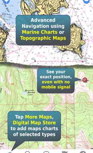
Turn your iPhone or iPad into an outdoor GPS or marine chart plotter, complete with the detailed specialized maps needed for your activity. Maps are stored on the device for offline use, when you don't have any network connection. The GPS will show your location even where you have no mobile phone signal.
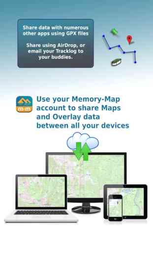
The app can be used standalone, but the maps and overlay data may also be used on your home computer for planning, and for printing maps on paper. Then upload everything to your phone or tablet and enjoy navigating outdoors with high quality maps.
When you get home you can transfer your tracklog and points of interest back onto your computer, to see where you actually went, analyze your speed and elevation profile, and so on.
Features:
+ Fast scrolling and zooming
+ Import and export GPX files
+ Auto-rotate screen
+ Screen lock to prevent accidental screen touches while recording a track
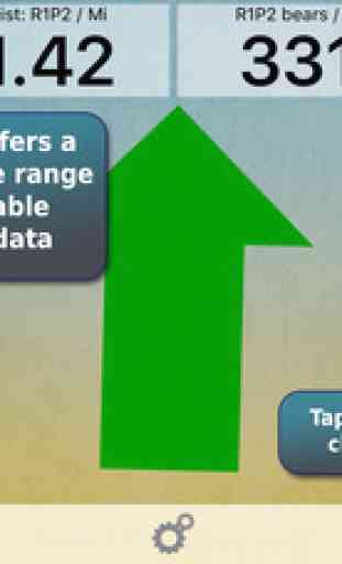
+ Shows speed and direction of travel, even while walking slowly
+ Support for GPS and Compass sensors, where available.
+ Placename index, works offline
+ Moving map, lock GPS position and automatically scroll the map
+ Records tracklogs with app running in the background
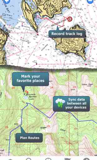
+ Create and edit marks, which may be linked to a web URL
+ Plan routes, measure distance and bearings.
+ Shows Altitude
+ Lat/Long, UTM and British National Grid coordinate systems
+ Email position marks or tracklogs as GPX files
+ Load maps from Memory-Map PC navigation software
Battery Use Disclaimer: "Continued use of GPS running in the background can dramatically decrease battery life."
The app can be used standalone, but the maps and overlay data may also be used on your home computer for planning, and for printing maps on paper. Then upload everything to your phone or tablet and enjoy navigating outdoors with high quality maps.
When you get home you can transfer your tracklog and points of interest back onto your computer, to see where you actually went, analyze your speed and elevation profile, and so on.
Features:
+ Fast scrolling and zooming
+ Import and export GPX files
+ Auto-rotate screen
+ Screen lock to prevent accidental screen touches while recording a track
+ Shows speed and direction of travel, even while walking slowly
+ Support for GPS and Compass sensors, where available.
+ Placename index, works offline
+ Moving map, lock GPS position and automatically scroll the map
+ Records tracklogs with app running in the background
+ Create and edit marks, which may be linked to a web URL
+ Plan routes, measure distance and bearings.
+ Shows Altitude
+ Lat/Long, UTM and British National Grid coordinate systems
+ Email position marks or tracklogs as GPX files
+ Load maps from Memory-Map PC navigation software
Battery Use Disclaimer: "Continued use of GPS running in the background can dramatically decrease battery life."
Category : Navigation
Related searches