AgVault™
** Fly your DJI Phantom, Inspire and Matrice with AgVault! **
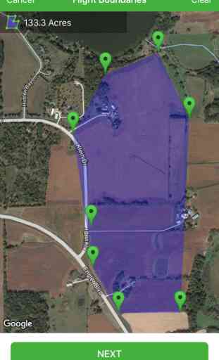
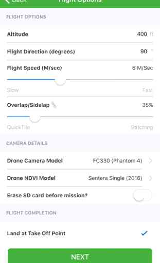
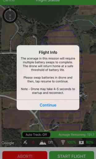
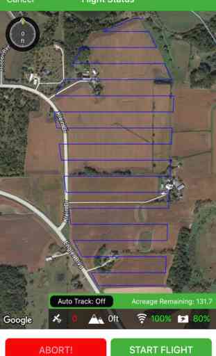
Autonomous mission planning and DJI camera trigger functions make it easy to survey farm fields and other large areas. Select the area you want to survey using our intuitive map and pin interface, set your camera parameters and launch the drone! AgVault will automatically capture color images using the stock DJI camera at the correct intervals and prepare them for making QuickTiles in the AgVault desktop software, or for other third party stitching tools. Now, AgVault provides an end to end solution for customers seeking fast, easy NDVI scouting.
AgVault mobile also captures boots-on-the-ground photos and keeps track of the where, when and why behind every photo. Photos taken with AgVault live with your drone data and are instantly available to your entire team. Every photo is precisely geo-located in your field, and presented along with your drone data giving you top to bottom awareness of what's happening on your land. Track photos by date, time, place and even tag them by what's in the frame.
Photos appear as dots in the AgVault desktop client making it simple to precisely locate specific photos throughout your field.
Category : Business
Related searches