Drone Buddy-Fly UAV Safe Weather,Wind,No Fly Zone
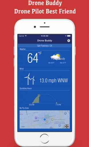
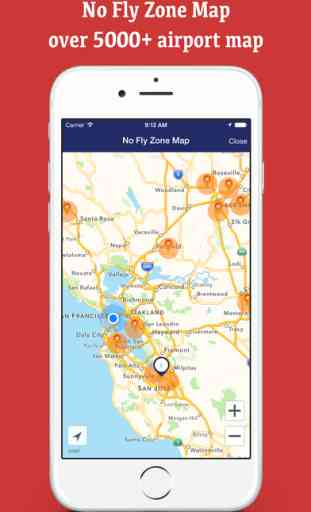
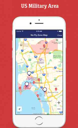
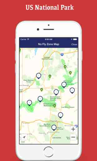
Drone Buddy is a handy iPhone/iPad app for drone pilots. It shows your local weather condition, wind speed, wind direction, kp geomagnetic index, Local Sunrise and Sunset Time. It also contains no fly zone map to avoid flying drone. No fly zone contains over 5000+ major airports in the world, US Military area and US National Park. You can customize the no fly zone to show different area.
Weather Data From Forecast.io.
Tap the temperature to convert the unit between celsius and fahrenheit.
Tap wind speed to convert the unit between mph and kph.
Kp Index Data From NOAA:
http://www.swpc.noaa.gov/products/planetary-k-index
No Fly Zone Map Data Source:
https://github.com/mapbox/drone-feedback
Disclaimer: We don't assume responsibility for the accuracy of the data in this app. You are responsible for your own drone flight accident or damage.
Finally, we hope you enjoy your flight and fly safe!
Send missing airport & no fly zone info to [email protected]
Send feedback to: [email protected]
Facebook: http://facebook.com/greenlaketech
App Video:
https://youtu.be/E0uPn12nFZ0
Category : Utilities
Related searches