Hong Kong Rail Map - Kowloon & Islands
*Free App of All Railway Network in Hong Kong*
- MTR(Subways, Railways) & Tram
This application offers the railway maps covering all over Hong Kong.
We hope this app will be of help to your smooth transit and good travel!
[Main Features of the latest version]
- Searching by the station name
- Jumping to your present location
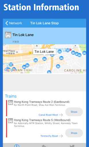
- Train information from every station
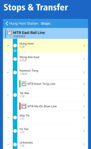
- Stops & transfer information of all lines
- Check tweets around the station by connecting with Twitter
- Free automatically updates to the latest versions of maps
- Flexible zoom up and scrolling
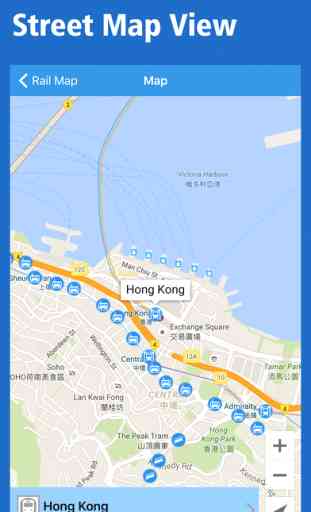
- Switch to Street Map View at every stations
- Weather information around the station
- Offline browsing is available (If you downloaded maps in advance)
- Multiple languages
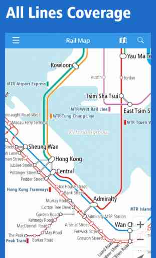
[Area Coverage] *All Lines, All Station in Hong Kong*
- MTR(Subways & Railways): Island Line, Kwun Tong Line, Tsuen Wan Line, Tseung Kwan O Line, Tung Chung Line, Airport Express, Disneyland Resort Line, East Rail, Ma On Shan Line, West Rail & Light Rail
- Others: Hong Kong Tramways, Peak Tram & Ngong Ping 360
- Airport: Hong Kong International Airport
- MTR(Subways, Railways) & Tram
This application offers the railway maps covering all over Hong Kong.
We hope this app will be of help to your smooth transit and good travel!
[Main Features of the latest version]
- Searching by the station name
- Jumping to your present location
- Train information from every station
- Stops & transfer information of all lines
- Check tweets around the station by connecting with Twitter
- Free automatically updates to the latest versions of maps
- Flexible zoom up and scrolling
- Switch to Street Map View at every stations
- Weather information around the station
- Offline browsing is available (If you downloaded maps in advance)
- Multiple languages
[Area Coverage] *All Lines, All Station in Hong Kong*
- MTR(Subways & Railways): Island Line, Kwun Tong Line, Tsuen Wan Line, Tseung Kwan O Line, Tung Chung Line, Airport Express, Disneyland Resort Line, East Rail, Ma On Shan Line, West Rail & Light Rail
- Others: Hong Kong Tramways, Peak Tram & Ngong Ping 360
- Airport: Hong Kong International Airport
Category : Travel
Related searches