Pix4Dcapture
Pix4Dcapture allows you to turn your drone into a mapping and measuring tool by defining autonomous mapping flights.
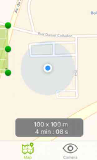
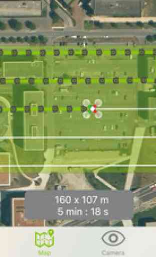
• Select an area for mapping.
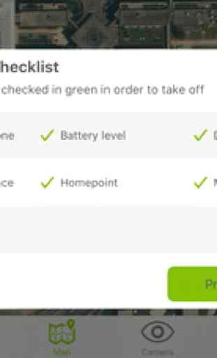
• Start a fully autonomous mission.
• Images are taken automatically and are geo-tagged.
• Interrupt mission at any time in case of danger.
• Transfer images to your computer.
• Guide on how to convert images into maps and 3D models using Pix4Dmapper desktop software or on the cloud.
Currently, the app supports and was tested for DJI Phantom 4, DJI Phantom 3 Standard, DJI Phantom 3 Advanced, DJI Phantom 3 Professional, DJI Inspire1, DJI Matrice 100 and Parrot Bebop2. Make sure you have the latest firmware installed.
The app is not an autopilot and does not avoid obstacles. Watch this video for more information on using Pix4Dcapture: http://youtu.be/YKOeGjfCFUw
Pix4D accepts no liability for damage, injuries or legalities from the misuse of this app. Use only in safe environments.
To convert images captured with the app to maps and 3D models, download the desktop software Pix4Dmapper: pix4d.com/download.
Video : http://youtu.be/w8L4pT81xCY
• Select an area for mapping.
• Start a fully autonomous mission.
• Images are taken automatically and are geo-tagged.
• Interrupt mission at any time in case of danger.
• Transfer images to your computer.
• Guide on how to convert images into maps and 3D models using Pix4Dmapper desktop software or on the cloud.
Currently, the app supports and was tested for DJI Phantom 4, DJI Phantom 3 Standard, DJI Phantom 3 Advanced, DJI Phantom 3 Professional, DJI Inspire1, DJI Matrice 100 and Parrot Bebop2. Make sure you have the latest firmware installed.
The app is not an autopilot and does not avoid obstacles. Watch this video for more information on using Pix4Dcapture: http://youtu.be/YKOeGjfCFUw
Pix4D accepts no liability for damage, injuries or legalities from the misuse of this app. Use only in safe environments.
To convert images captured with the app to maps and 3D models, download the desktop software Pix4Dmapper: pix4d.com/download.
Video : http://youtu.be/w8L4pT81xCY
Category : Utilities
Related searches