Soldier's Field Card
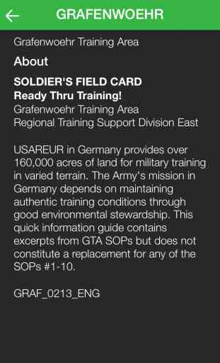
Success of the Army's mission depends on sustaining realistic training conditions through good environmental stewardship. The Integrated Training Area Management (ITAM) program - a core component of the U.S. Army Europe's Sustainable Range Program (USAREUR SRP) - contributes to this goal, in part by establishing the guidelines contained in the Soldier's Field Card app.
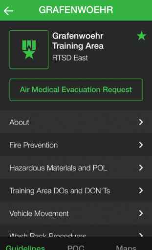
Sections of the app are training area and language-specific and cover topics such as:
- Medical Evacuation Requests, Emergency Numbers and Frequencies
- Spill Prevention / Response (including HAZMAT / POL)
- Vehicle Movement, Washrack Procedures, Policing Training Areas
- Training Area DOs and DON'Ts
- Wildlife, Fire Prevention
- IED / UXO Reporting
- Camouflage
- Safety Risk Assessment Models
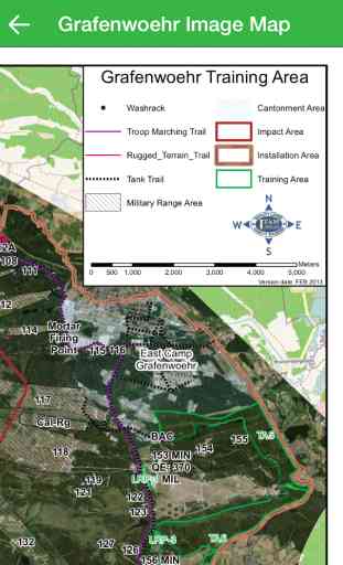
- Orientation and Training Area Maps
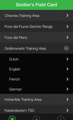
The app has Cards for the following Training Areas:
- Ansbach TSC
- Babadag
- Bamberg TSC
- Baumholder LTA/MTA
- Cao Malnisio Range
- Cellina Meduna / Juliet DZ / Frida DZ / Dandolo MOUT
- Grafenwoehr
- JMRC Hohenfels
- Monte Carpegna
- Monte Romano
- Novo Selo
- San Giorgio Urban Assault Course
- Schweinfurt TSC
- Slunj
- Stuttgart TSC
- T-Series
- Valle Ugione and Lustrissimi
- Wiesbaden TSC
Sections of the app are training area and language-specific and cover topics such as:
- Medical Evacuation Requests, Emergency Numbers and Frequencies
- Spill Prevention / Response (including HAZMAT / POL)
- Vehicle Movement, Washrack Procedures, Policing Training Areas
- Training Area DOs and DON'Ts
- Wildlife, Fire Prevention
- IED / UXO Reporting
- Camouflage
- Safety Risk Assessment Models
- Orientation and Training Area Maps
The app has Cards for the following Training Areas:
- Ansbach TSC
- Babadag
- Bamberg TSC
- Baumholder LTA/MTA
- Cao Malnisio Range
- Cellina Meduna / Juliet DZ / Frida DZ / Dandolo MOUT
- Grafenwoehr
- JMRC Hohenfels
- Monte Carpegna
- Monte Romano
- Novo Selo
- San Giorgio Urban Assault Course
- Schweinfurt TSC
- Slunj
- Stuttgart TSC
- T-Series
- Valle Ugione and Lustrissimi
- Wiesbaden TSC
Category : Reference
Related searches